
Matokeo ya utafutaji
Je, ulitaka kutafuta: s mars
- (help)CS1 maint: date auto-translated (link) Google Maps - Kenge HERE Maps - Kenge 4°48′20″S 17°02′30″E / 4.80556°S 17.04167°E / -4.80556; 17.04167...1 KB (maneno 113) - 05:15, 12 Desemba 2021
- DAGORETTI, NAIROBI, Kenya: Maps". www.maphill.com (kwa Kiingereza). Iliwekwa mnamo 2017-05-10. 1°18′S 36°45′E / 1.300°S 36.750°E / -1.300; 36.750...508 bytes (maneno 50) - 14:36, 3 Novemba 2023
 34°36′S na 58°23′W. Magharibi kwa Buenos Aires zinaanza tambarare zenye rutuba za pampa. Wikimedia Commons ina media kuhusu: Buenos Aires Google Maps Satellite...2 KB (maneno 120) - 01:28, 2 Agosti 2023
 mnamo 8 Mei 2018. {{cite web}}: More than one of |accessdate= na |access-date= specified (help)CS1 maint: date auto-translated (link) Kigezo:Google maps...2 KB (maneno 124) - 10:27, 28 Februari 2023
 wa kusini na Kasheshe upande wa magharibi.Majira-nukta yake ni 0°36'46.2"S, 30°15'35.7"E (Latitude:-0.612833; Longitude:30.259917). Kigezo:Google maps...1 KB (maneno 78) - 06:21, 25 Julai 2021
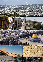 Hebrew University of Jerusalem Modern maps, post-1947 Ilihifadhiwa 16 Juni 2008 kwenye Wayback Machine. from PASSIA Maps of Jerusalem Ilihifadhiwa 24 Oktoba...7 KB (maneno 651) - 03:53, 9 Machi 2024
 Cambridge University Press, ku. 18–19. Schütte, Gudmund (1917), Ptolemy's Maps of Northern Europe: A Reconstruction of the Prototypes, Copenhagen: Græbe...4 KB (maneno 264) - 16:37, 10 Oktoba 2016
 Maps) Lat: -24° 43' 28.33", Lng: +15° 28' 15.23" Namibia Tourism Board - Southern Region Ilihifadhiwa 25 Agosti 2006 kwenye Wayback Machine. 24°43′S 15°28′E...1 KB (maneno 151) - 20:21, 20 Januari 2021
- {{cite web}}: CS1 maint: date auto-translated (link) https://www.google.com/maps/dir/Dar+es+Salaam,+Tanzania/Kihansi+hydro+power+plant,+Mlimba,+Tanzania/@-7...3 KB (maneno 375) - 21:16, 5 Januari 2022
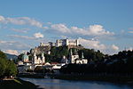 Wayback Machine. Tourist attractions in Salzburg, with descriptions and maps (Kiingereza) Pictureserver Ilihifadhiwa 21 Januari 2007 kwenye Wayback Machine...5 KB (maneno 411) - 06:13, 12 Machi 2024
- 8400; Longitude: 31.4600)).. Road Distance Between Masaka And Kakuuto With Map Road Distance Between Kakuuto And Mutukula With Map Kigezo:Google maps...2 KB (maneno 127) - 14:00, 25 Julai 2021
 Press, university press & publisher MIT Maps Ilihifadhiwa 5 Desemba 2006 kwenye Wayback Machine. Early Maps of both the Boston and Cambridge Campuses...2 KB (maneno 203) - 10:46, 13 Aprili 2023
- Ishaka, Western Region, Uganda". Globefeed.com (GFC). Iliwekwa mnamo 23 Mei 2016.{{cite web}}: CS1 maint: date auto-translated (link) Kigezo:Google maps...2 KB (maneno 153) - 14:28, 24 Julai 2021
 Orodha ya miji ya Algeria (fungu S)Tolga (55 809) "Algeria: Provinces & Major Cities - Population Statistics in Maps and Charts". City Population. Wikimedia Commons ina media kuhusu: Orodha...10 KB (maneno 231) - 13:48, 6 Desemba 2021
- Kikagati, Isingiro District, Uganda". Globefeed.com. Iliwekwa mnamo 11 Machi 2020.{{cite web}}: CS1 maint: date auto-translated (link) Kigezo:Google maps...2 KB (maneno 189) - 12:05, 24 Julai 2021
- makao makuu ya mkoa. "Tanzania: Regions and Cities - Population Statistics, Maps, Charts, Weather and Web Information". www.citypopulation.de. Iliwekwa mnamo...2 KB (maneno 154) - 11:17, 16 Novemba 2023
 auto-translated (link) Wikimedia Commons ina media kuhusu: Mto Brahmaputra http://www.mapsofindia.com/maps/rivers/brahmaputra.html - Brahmaputra River Map...3 KB (maneno 295) - 06:50, 13 Julai 2021
- {{cite web}}: CS1 maint: date auto-translated (link) https://www.google.com/maps/place/6%C2%B048'40.0%22S+39%C2%B017'12.0%22E/@-6.8112298,39.2859093,117m/data=...3 KB (maneno 218) - 09:27, 27 Machi 2023
 Summary Trade Statistics Paraguay Utalii Paraguay.com: Tradition, Culture, Maps, Tourism Tourism in Paraguay, information, pictures and more. Turismo.com...5 KB (maneno 256) - 12:05, 29 Mei 2024
 graphical airport finder via Google Maps ATCSCC Real-time Airport Status page - shows airport delay times for major U.S. airports (FAA) FlightCentral.net...5 KB (maneno 668) - 08:57, 9 Novemba 2023


