
Faili:Western-mediterranean-rome-hadrian.jpg
Hakuna saizi kubwa zaidi.
Western-mediterranean-rome-hadrian.jpg (piseli 800 × 600, saizi ya faili: 437 KB, aina ya MIME: image/jpeg)
| Faili hili linatoka Wikimedia Commons. Maelezo yapo kule kwenye ukurasa wake wa maelezo unaonekana hapo chini.
|
Muhtasari
| Maelezo |
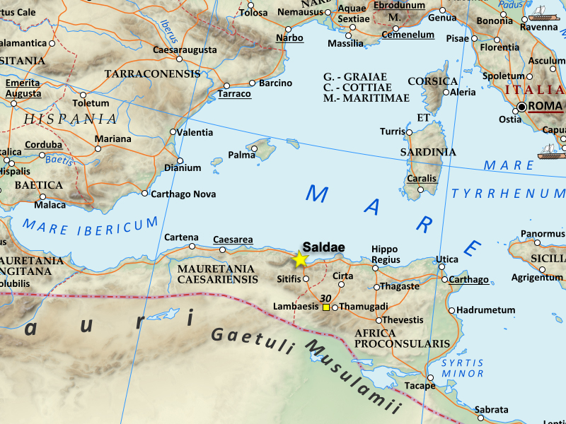
English: This is a map of the Western Roman empire around the Mediterranean, around the time of Hadrian in the 2nd century AD. It specifically shows Saldae, at this time an important port city, and later the capital of the Vandal Kingdom. |
| Tarehe | |
| Chanzo | This is based on an existing Wikipedia image, which I cropped and altered to emphasize Saldae. I'm uploading my image under the same CCA-SA3+CFDL license the original file had |
| Mwandishi | Kazvorpal |
- Other information
English: The original file I used was https://en.wikipedia.org/wiki/File:Roman_Empire_125.png
Hatimiliki
I, the copyright holder of this work, hereby publish it under the following licenses:

|
Ruhusa inakubalika kunakili, kusambaza na/au kurekebisha chini ya matakwa ya GNU Free Documentation License, Toleo 1.2 au toleo lolote lile la baadaye ambalo litachapishwa na Free Software Foundation; lisilo na Sehemu Tofauti, lisilo na Maandishi-Kava-Kwa-Mbele, na lisilo na Maandishi-Kava-Kwa -Nyuma. Nakala ya hatimiliki inajumlishwa kwenye sehemu ilioitwa GNU Free Documentation License. |
Faili hii imeidhinishwa chini ya Creative Commons Attribution- Attribution-Share Alike 3.0 Unported leseni.
- Uko huru:
- kushiriki – kunakili na kusambaza kazi hiyo
- kwa remix – kurekebisha kazi
- Chini ya masharti yafuatayo:
- sifa – Ni lazima utoe mkopo unaofaa, utoe kiungo cha leseni, na uonyeshe ikiwa mabadiliko yalifanywa. Unaweza kufanya hivyo kwa njia yoyote inayofaa, lakini si kwa njia yoyote inayopendekeza mtoa leseni akuidhinishe wewe au matumizi yako.
Unaweza kuchagua leseni ya chaguo lako.
Historia ya faili
Bonyeza tarehe/saa kuona faili kama ilivyoonekana wakati huo.
| Tarehe/Saa | Picha ndogo | Vipimo | Mtumiaji | Maelezo | |
|---|---|---|---|---|---|
| sasa hivi | 03:44, 6 Januari 2014 | | 800 × 600 (437 KB) | Kazvorpal | {{subst:Upload marker added by en.wp UW}} {{Information |Description = {{en|This is a map of the Western Roman empire around the Mediterranean, around the time of Hadrian in the 2nd century AD. It specifically shows Saldae, at this time an important po... |
Matumizi ya faili
Kurasa hizi 2 zimeunganishwa na faili hili:
Matumizi ya faili ulimwenguni
Wiki nyingine hutumia faili hizi:
- Matumizi kwa ar.wikipedia.org
- Matumizi kwa ca.wikipedia.org
- Matumizi kwa de.wikipedia.org
- Matumizi kwa el.wikipedia.org
- Matumizi kwa en.wikipedia.org
- Matumizi kwa es.wikipedia.org
- Matumizi kwa fr.wikipedia.org
- Matumizi kwa sl.wikipedia.org
- Matumizi kwa www.wikidata.org