
Faili:RoadThroughMeiringspoort.jpg
Ukubwa wa hakikisho: piseli 800 × 555. Ukubwa zingine: piseli 320 × 222 | piseli 640 × 444 | piseli 1,024 × 711 | piseli 1,280 × 888 | piseli 2,560 × 1,777 | piseli 4,980 × 3,456.
Faili halisi (piseli 4,980 × 3,456, saizi ya faili: 11.6 MB, aina ya MIME: image/jpeg)
| Faili hili linatoka Wikimedia Commons. Maelezo yapo kule kwenye ukurasa wake wa maelezo unaonekana hapo chini.
|
Muhtasari
| Maelezo |
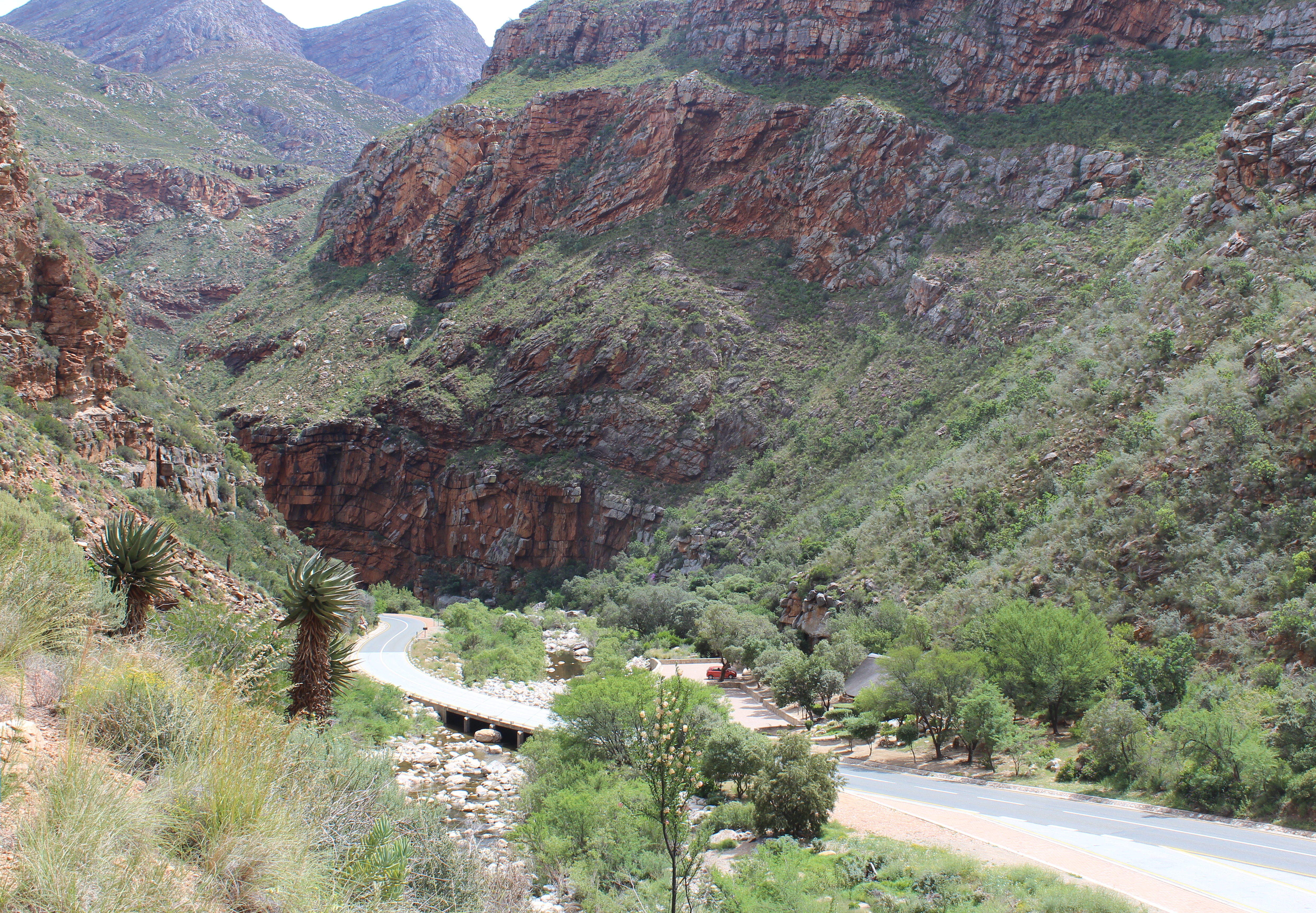
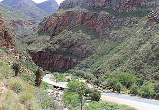
English: View of the South African N12 road as it passes through Meiringspoort, a 20 km (12 mi) gorge with cliffs of up to 700 m (2300&bnbsp;ft) in the Swartberg, a mountain range that separates the Great Karoo from the Little Karoo. The folds in the Swartberg are clearly visible in both the gorge and in this picture. The Groot River (in spite of its name, little more than a stream) passes through the gorge - one of the many crossings of the N12 and the river are visible in the lower part of the picture. The town of Oudtshoorn is about 35 km (22 mi) from the southern portal of the gorge.
Afrikaans: Uitsig op die Suid-Afrikaanse N12-pad in die omgewing Meiringspoort. Meiringspoort is 'n 20 km lank met kranse van 700 m. Hy sny deur die Swartberg tussen die Groot-Karoo en die Klein-Karoo. Die voue in die Swartberg is duidelik sigbaar in die kloof. Een van die kruisings van die N12 oor die Grootrivier wat deur die poort loop is sigbaar in die onderste deel van die prentjie. Die dorp Oudtshoorn is sowat 35 km vanaf die suidelike portaal van die kloof. |
| Tarehe | |
| Chanzo | Kazi yangu |
| Mwandishi | Martinvl |
| Camera location | | View this and other nearby images on: OpenStreetMap |
|---|
|
This place is a UNESCO World Heritage Site under the reference 1007.
|
-
 Meiringspoort tourist information

Hatimiliki
I, the copyright holder of this work, hereby publish it under the following license:
This file is licensed under the Creative Commons Attribution-Share Alike 4.0 International license.
- Uko huru:
- kushiriki – kunakili na kusambaza kazi hiyo
- kwa remix – kurekebisha kazi
- Chini ya masharti yafuatayo:
- sifa – Ni lazima utoe mkopo unaofaa, utoe kiungo cha leseni, na uonyeshe ikiwa mabadiliko yalifanywa. Unaweza kufanya hivyo kwa njia yoyote inayofaa, lakini si kwa njia yoyote inayopendekeza mtoa leseni akuidhinishe wewe au matumizi yako.
Historia ya faili
Bonyeza tarehe/saa kuona faili kama ilivyoonekana wakati huo.
| Tarehe/Saa | Picha ndogo | Vipimo | Mtumiaji | Maelezo | |
|---|---|---|---|---|---|
| sasa hivi | 14:19, 12 Desemba 2015 | | 4,980 × 3,456 (11.6 MB) | Martinvl | User created page with UploadWizard |
Matumizi ya faili
Ukurasa huu umeunganishwa na faili hili:
Matumizi ya faili ulimwenguni
Wiki nyingine hutumia faili hizi:
- Matumizi kwa af.wikipedia.org
- Matumizi kwa ca.wikipedia.org
- Matumizi kwa ceb.wikipedia.org
- Matumizi kwa de.wikipedia.org
- Matumizi kwa en.wikipedia.org
- Matumizi kwa fy.wikipedia.org
- Matumizi kwa nl.wikipedia.org
- Matumizi kwa no.wikipedia.org
- Matumizi kwa pl.wikipedia.org
- Matumizi kwa www.wikidata.org