
Faili:Cuvette districts.png

Ukubwa wa hakikisho: piseli 776 × 600. Ukubwa zingine: piseli 311 × 240 | piseli 621 × 480 | piseli 994 × 768 | piseli 1,056 × 816.
Faili halisi (piseli 1,056 × 816, saizi ya faili: 28 KB, aina ya MIME: image/png)
| Faili hili linatoka Wikimedia Commons. Maelezo yapo kule kwenye ukurasa wake wa maelezo unaonekana hapo chini.
|
| Maelezo |
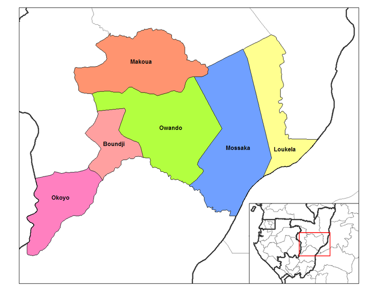
English: Map of the districts of Cuvette region in the Republic of the Congo. Created by Rarelibra 13:28, 12 September 2006 (UTC) for public domain use, using MapInfo Professional v8.5 and various mapping resources. |
| Tarehe | 12 Septemba 2006 (original upload date) |
| Chanzo | Transferred from en.wikipedia to Commons by Gikü. |
| Mwandishi | Rarelibra at Kiingereza Wikipedia |
Hatimiliki
| This work has been released into the public domain by its author, Rarelibra at Kiingereza Wikipedia. This applies worldwide. Katika nchi zingine hii haiwezekani kisheria; kama ni hivyo: Rarelibra grants anyone the right to use this work for any purpose, without any conditions, unless such conditions are required by law. |
Kumbukumbu ya upakizaji wa asili
The original description page was here. All following user names refer to en.wikipedia.
- 2006-09-12 13:35 Rarelibra 1056×816× (28455 bytes) Map of the districts of Cuvette region in the Republic of the Congo. Created by ~~~~ for public domain use, using MapInfo Professional v8.5 and various mapping resources.
- 2006-09-12 13:28 Rarelibra 1056×816× (32029 bytes) Map of the districts of Cuvette region in the Republic of the Congo. Created by ~~~~ for public domain use, using MapInfo Professional v8.5 and various mapping resources.
Historia ya faili
Bonyeza tarehe/saa kuona faili kama ilivyoonekana wakati huo.
| Tarehe/Saa | Picha ndogo | Vipimo | Mtumiaji | Maelezo | |
|---|---|---|---|---|---|
| sasa hivi | 17:17, 2 Desemba 2008 | | 1,056 × 816 (28 KB) | Gikü | {{Information |Description={{en|Map of the districts of Cuvette region in the Republic of the Congo. Created by Rarelibra 13:28, 12 September 2006 (UTC) for public domain use, using MapInfo Professional v8.5 and various mapping reso |
Matumizi ya faili
Ukurasa huu umeunganishwa na faili hili:
Matumizi ya faili ulimwenguni
Wiki nyingine hutumia faili hizi:
- Matumizi kwa de.wikipedia.org
- Matumizi kwa en.wikipedia.org
- Matumizi kwa es.wikipedia.org
- Matumizi kwa fr.wikipedia.org
- Matumizi kwa ha.wikipedia.org
- Matumizi kwa ig.wikipedia.org
- Matumizi kwa it.wikipedia.org
- Matumizi kwa lt.wikipedia.org
- Matumizi kwa ro.wikipedia.org
- Matumizi kwa ru.wikipedia.org
- Matumizi kwa tr.wikipedia.org
- Matumizi kwa ts.wikipedia.org
- Matumizi kwa www.wikidata.org
- Matumizi kwa yo.wikipedia.org
- Matumizi kwa zu.wikipedia.org