
Faili:Africa-countries-EAC.png
Hakuna saizi kubwa zaidi.
Africa-countries-EAC.png (piseli 350 × 350, saizi ya faili: 10 KB, aina ya MIME: image/png)
| Faili hili linatoka Wikimedia Commons. Maelezo yapo kule kwenye ukurasa wake wa maelezo unaonekana hapo chini.
|

|
File:Africa-countries-EAC.svg is a vector version of this file. It should be used in place of this PNG file.
File:Africa-countries-EAC.png → File:Africa-countries-EAC.svg
For more information, see Help:SVG. |
 |
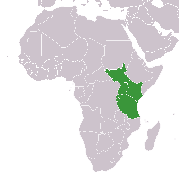
- Description: Map of African Countries of EAC
- Beschreibung: Karte von afrikanischen Ländern der EAC
- old image originally from Wikimedia Commons Image:BlankMap-Africa.png
- new image is self-created
- created by de:Benutzer:Sven-steffen arndt
| I, the copyright holder of this work, release this work into the public domain. This applies worldwide. Katika nchi zingine hii haiwezekani kisheria; kama ni hivyo: I grant anyone the right to use this work for any purpose, without any conditions, unless such conditions are required by law. |
Historia ya faili
Bonyeza tarehe/saa kuona faili kama ilivyoonekana wakati huo.
| Tarehe/Saa | Picha ndogo | Vipimo | Mtumiaji | Maelezo | |
|---|---|---|---|---|---|
| sasa hivi | 20:30, 9 Machi 2016 | | 350 × 350 (10 KB) | Einsamer Schütze | South Sudan joined as new member on march 2nd 2016 |
| 12:26, 15 Julai 2011 |  | 350 × 350 (11 KB) | Nicolay Sidorov | Hala'ib triangle is a dispute territory | |
| 15:56, 9 Julai 2011 |  | 350 × 350 (11 KB) | Maphobbyist | South Sudan has become independent on July 9, 2011. Sudan and South Sudan are shown with the new international border between them. | |
| 08:09, 1 Julai 2007 |  | 350 × 350 (11 KB) | Béka~commonswiki | Reverted to earlier revision | |
| 18:00, 11 Januari 2007 |  | 350 × 350 (11 KB) | Nightstallion | Reverted to earlier revision | |
| 19:38, 30 Novemba 2006 |  | 350 × 350 (11 KB) | Nightstallion | burundi and rwanda | |
| 22:50, 15 Aprili 2006 |  | 350 × 350 (11 KB) | Aris Katsaris | corrected and cropped a bit | |
| 17:33, 21 Agosti 2005 |  | 360 × 392 (7 KB) | Sven-steffen arndt | :'''Description''': Map of African Countries of EAC :'''Beschreibung''': Karte von afrikanischen Ländern der EAC :old image originally from Wikimedia Commons Image:BlankMap-Africa.png :new image is self-created :'''created by''' [[:de:Benutzer:Sven- |
Matumizi ya faili
Hakuna kurasa zozote zinazotumia faili hii.
Matumizi ya faili ulimwenguni
Wiki nyingine hutumia faili hizi:
- Matumizi kwa en.wikipedia.org