
Faili:South Africa Provinces showing FS.png
Ukubwa wa hakikisho: piseli 800 × 578. Ukubwa zingine: piseli 320 × 231 | piseli 640 × 462 | piseli 1,024 × 740 | piseli 1,146 × 828.
Faili halisi (piseli 1,146 × 828, saizi ya faili: 20 KB, aina ya MIME: image/png)
| Faili hili linatoka Wikimedia Commons. Maelezo yapo kule kwenye ukurasa wake wa maelezo unaonekana hapo chini.
|
Muhtasari
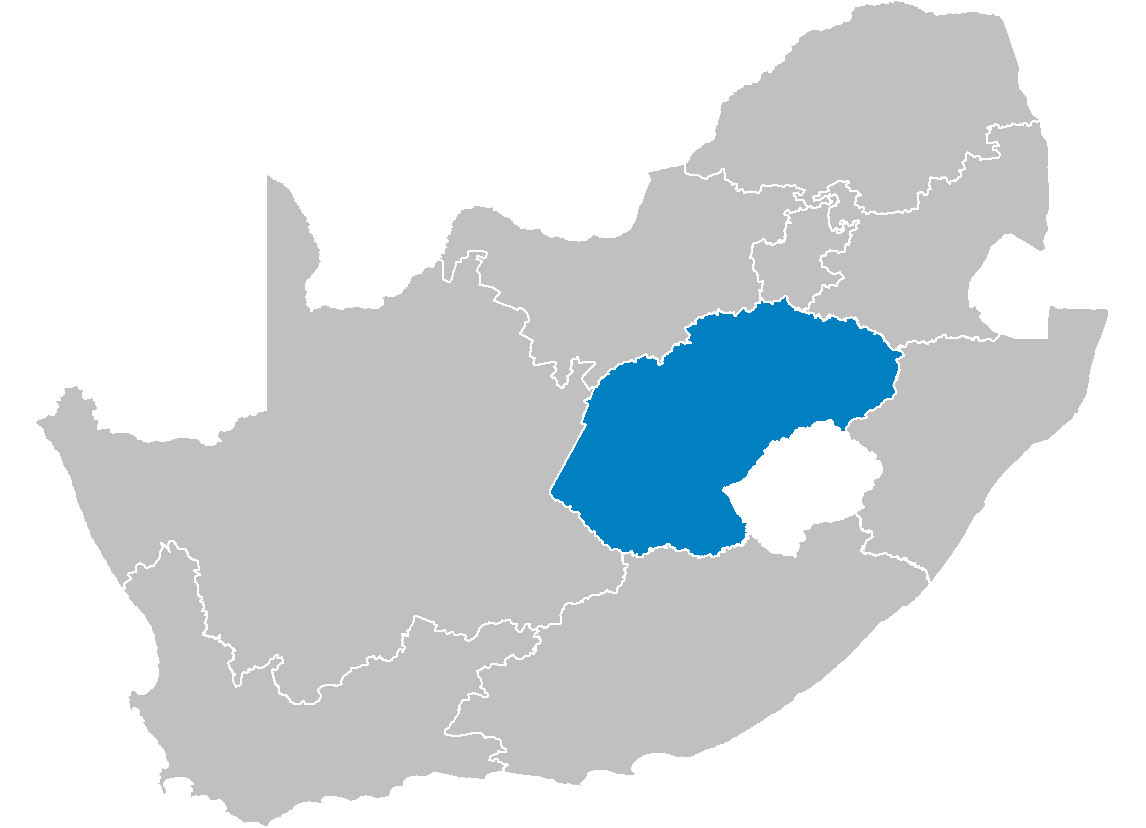
| Maelezo | Map of South Africa showing the Free State province after the 12th amendment of the constitution in December 2005. |
| Tarehe | |
| Chanzo | Created by me from Shapefile data from the Municipal Demarcation Board, South Africa. |
| Mwandishi | Wayne Dam (User:Waynedam) |
| Ruhusa (Kutumia faili tena) |
Dual-licensed under the GFDL and CC-By-SA-2.5, 2.0, and 1.0. |
Hatimiliki
I, the copyright holder of this work, hereby publish it under the following licenses:

|
Ruhusa inakubalika kunakili, kusambaza na/au kurekebisha chini ya matakwa ya GNU Free Documentation License, Toleo 1.2 au toleo lolote lile la baadaye ambalo litachapishwa na Free Software Foundation; lisilo na Sehemu Tofauti, lisilo na Maandishi-Kava-Kwa-Mbele, na lisilo na Maandishi-Kava-Kwa -Nyuma. Nakala ya hatimiliki inajumlishwa kwenye sehemu ilioitwa GNU Free Documentation License. |
| Faili hii imeidhinishwa chini ya Creative Commons Attribution- Attribution-Share Alike 3.0 Unported leseni. | ||
shiriki sawa – Ukichanganya, kubadilisha, au kujenga juu ya nyenzo, lazima usambaze michango yako chini ya same or compatible license kama ya awali. | ||
| This licensing tag was added to this file as part of the GFDL licensing update. |
This file is licensed under the Creative Commons Attribution-Share Alike 2.5 Generic, 2.0 Generic and 1.0 Generic license.
- Uko huru:
- kushiriki – kunakili na kusambaza kazi hiyo
- kwa remix – kurekebisha kazi
- Chini ya masharti yafuatayo:
- sifa – Ni lazima utoe mkopo unaofaa, utoe kiungo cha leseni, na uonyeshe ikiwa mabadiliko yalifanywa. Unaweza kufanya hivyo kwa njia yoyote inayofaa, lakini si kwa njia yoyote inayopendekeza mtoa leseni akuidhinishe wewe au matumizi yako.
Unaweza kuchagua leseni ya chaguo lako.
Hatimiliki
I, the copyright holder of this work, hereby publish it under the following licenses:
|
|
Ruhusa inakubalika kunakili, kusambaza na/au kurekebisha chini ya matakwa ya GNU Free Documentation License, Toleo 1.2 au toleo lolote lile la baadaye ambalo litachapishwa na Free Software Foundation; lisilo na Sehemu Tofauti, lisilo na Maandishi-Kava-Kwa-Mbele, na lisilo na Maandishi-Kava-Kwa -Nyuma. Nakala ya hatimiliki inajumlishwa kwenye sehemu ilioitwa GNU Free Documentation License. |
| Faili hii imeidhinishwa chini ya Creative Commons Attribution- Attribution-Share Alike 3.0 Unported leseni. | ||
shiriki sawa – Ukichanganya, kubadilisha, au kujenga juu ya nyenzo, lazima usambaze michango yako chini ya same or compatible license kama ya awali. | ||
| This licensing tag was added to this file as part of the GFDL licensing update. |
This file is licensed under the Creative Commons Attribution 2.5 Generic license.
- Uko huru:
- kushiriki – kunakili na kusambaza kazi hiyo
- kwa remix – kurekebisha kazi
- Chini ya masharti yafuatayo:
- sifa – Ni lazima utoe mkopo unaofaa, utoe kiungo cha leseni, na uonyeshe ikiwa mabadiliko yalifanywa. Unaweza kufanya hivyo kwa njia yoyote inayofaa, lakini si kwa njia yoyote inayopendekeza mtoa leseni akuidhinishe wewe au matumizi yako.
Unaweza kuchagua leseni ya chaguo lako.
Historia ya faili
Bonyeza tarehe/saa kuona faili kama ilivyoonekana wakati huo.
| Tarehe/Saa | Picha ndogo | Vipimo | Mtumiaji | Maelezo | |
|---|---|---|---|---|---|
| sasa hivi | 14:16, 29 Aprili 2006 | | 1,146 × 828 (20 KB) | Waynedam | == Summary == {{Information| |Description=Map of South Africa showing the Free State province after the 12th amendment of the constitution in December 2005. |Source=Created by me from Shapefile data from the [http://www.demarcation.org.za/ Municipal Dema |
Matumizi ya faili
Ukurasa huu umeunganishwa na faili hili:
Matumizi ya faili ulimwenguni
Wiki nyingine hutumia faili hizi:
- Matumizi kwa ar.wikipedia.org
- Matumizi kwa be-tarask.wikipedia.org
- Matumizi kwa de.wikipedia.org
- Matumizi kwa en.wikipedia.org
- Phuthaditjhaba
- Air Force Base Bloemspruit
- Arlington, South Africa
- Fouriesburg
- Swinburne, Free State
- Hobhouse, South Africa
- Kestell
- Ladybrand
- Marquard
- Vrede
- Warden, Free State
- Hennenman
- Hertzogville
- Odendaalsrus
- Ventersburg
- Verkeerdevlei
- Edenville, South Africa
- Koppies
- Luckhoff
- Oranjeville
- Petrusburg
- Reddersburg
- Tweeling
- Vredefort
- Heuwelsig
- Fauna, Bloemfontein
- Willows, Bloemfontein
- Template:FreeState-geo-stub
- Zastron
- Marseilles, Free State
- Tussen-die-Riviere Nature Reserve
- Caledon Nature Reserve
- Soetdoring Nature Reserve
- Sandveld Nature Reserve
- Bell's Pass
- Kalkfontein Nature Reserve
- Koppies Dam Nature Reserve
- Maria Moroka Nature Reserve
- Seekoeivlei Nature Reserve
- Willem Pretorius Game Reserve
- Vierfontein
- Viljoensdrif
- Gariep Dam (town)
- Riebeeckstad
- Whites, Free State
- Van Stadensrus
- Tseki
Tazama matumizi zaidi ya kimataifa ya faili hii.