Faili:Caspianseamap.png

Ukubwa wa hakikisho: piseli 598 × 600. Ukubwa zingine: piseli 239 × 240 | piseli 600 × 602.
Faili halisi (piseli 600 × 602, saizi ya faili: 196 KB, aina ya MIME: image/png)
Historia ya faili
Bonyeza tarehe/saa kuona faili kama ilivyoonekana wakati huo.
| Tarehe/Saa | Picha ndogo | Vipimo | Mtumiaji | Maelezo | |
|---|---|---|---|---|---|
| sasa hivi | 02:00, 20 Agosti 2018 |  | 600 × 602 (196 KB) | SteinsplitterBot | Bot: Image rotated by 180° |
| 10:01, 19 Agosti 2018 |  | 600 × 602 (196 KB) | SteinsplitterBot | Bot: Image rotated by 180° | |
| 20:40, 8 Januari 2007 |  | 600 × 602 (199 KB) | Kmusser | ||
| 20:23, 8 Januari 2007 |  | 600 × 602 (212 KB) | Kmusser | ||
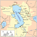
| 20:14, 8 Januari 2007 |  | 600 × 602 (212 KB) | Kmusser | This is a map of the Caspian Sea including a small locator map. The drainage basin of the Caspian Sea is in yellow. The map is based on USGS and Digital Chart of the World data. Note t |
Matumizi ya faili
Ukurasa huu umeunganishwa na faili hili:
Matumizi ya faili ulimwenguni
Wiki nyingine hutumia faili hizi:
- Matumizi kwa af.wikipedia.org
- Matumizi kwa am.wikipedia.org
- Matumizi kwa an.wikipedia.org
- Matumizi kwa ar.wikipedia.org
- Matumizi kwa az.wikipedia.org
- Matumizi kwa az.wiktionary.org
- Matumizi kwa ba.wikipedia.org
- Matumizi kwa be.wikipedia.org
- Matumizi kwa br.wikipedia.org
- Matumizi kwa ca.wikipedia.org
- Matumizi kwa csb.wikipedia.org
- Matumizi kwa cs.wikipedia.org
- Matumizi kwa cv.wikipedia.org
- Matumizi kwa de.wikipedia.org
- Matumizi kwa en.wikipedia.org
- Matumizi kwa en.wikivoyage.org
- Matumizi kwa eo.wikipedia.org
- Matumizi kwa es.wikipedia.org
- Matumizi kwa eu.wikipedia.org
- Matumizi kwa fa.wikipedia.org
- Matumizi kwa fa.wikibooks.org
- Matumizi kwa fi.wikipedia.org
- Matumizi kwa fo.wikipedia.org
- Matumizi kwa fr.wikipedia.org
- Matumizi kwa gan.wikipedia.org
- Matumizi kwa gd.wikipedia.org
- Matumizi kwa gu.wikipedia.org
Tazama matumizi zaidi ya kimataifa ya faili hii.


