
Faili:15th century map of Turkey region.jpg
Ukubwa wa hakikisho: piseli 800 × 600. Ukubwa zingine: piseli 320 × 240 | piseli 640 × 480 | piseli 1,024 × 768 | piseli 1,280 × 960 | piseli 2,048 × 1,536.
Faili halisi (piseli 2,048 × 1,536, saizi ya faili: 884 KB, aina ya MIME: image/jpeg)
| Faili hili linatoka Wikimedia Commons. Maelezo yapo kule kwenye ukurasa wake wa maelezo unaonekana hapo chini.
|
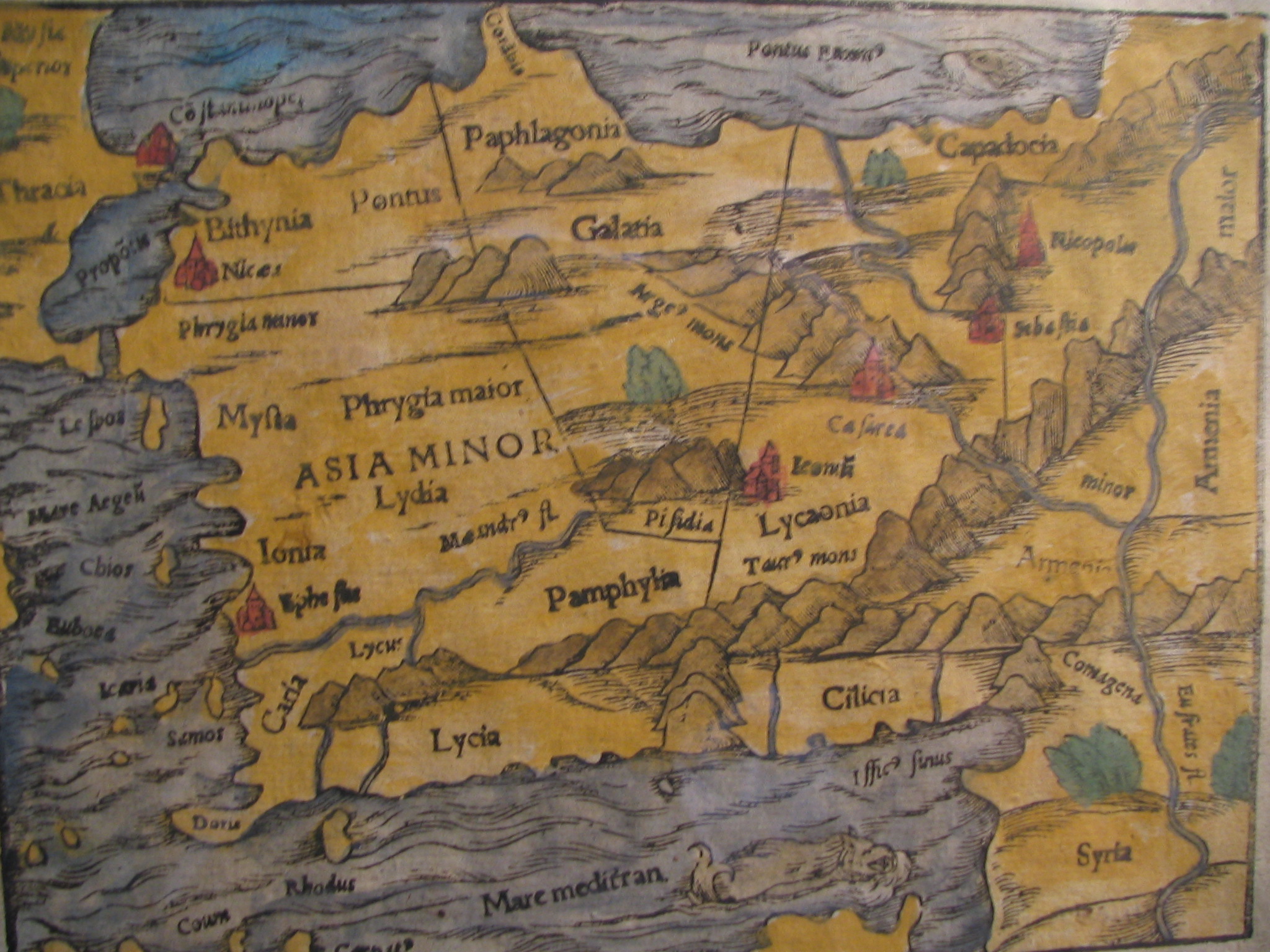
| Maelezo |
English: Picture of a map of the region of what is now Turkey from the 15th Century. I own this map, having purchased it, and have all official documentation regarding its authenticity. |
||||
| Tarehe | 15 century, Digitized on: 10 Desemba 2006, 19:42:23 | ||||
| Chanzo |
|
||||
| Mwandishi | Unknown author, Photographer: Electionworld | ||||
| Ruhusa (Kutumia faili tena) |
This file is licensed under the Creative Commons Attribution-Share Alike 2.5 Generic license.
|
||||

Historia ya faili
Bonyeza tarehe/saa kuona faili kama ilivyoonekana wakati huo.
| Tarehe/Saa | Picha ndogo | Vipimo | Mtumiaji | Maelezo | |
|---|---|---|---|---|---|
| sasa hivi | 14:04, 21 Februari 2018 | | 2,048 × 1,536 (884 KB) | Ket | Reverted to version as of 09:40, 17 December 2006 (UTC) |
| 14:03, 21 Februari 2018 |  | 2,048 × 1,536 (921 KB) | Ket | better contrast | |
| 09:40, 17 Desemba 2006 |  | 2,048 × 1,536 (884 KB) | Electionworld | {{ew|en|Rarelibra}} == Summary == Picture of a map of the region of what is now Turkey from the 15th Century. I own this map, having purchased it, and have all official documentation regarding its authenticity. == Licensing == {{cc-by-sa-2.5}} |
Matumizi ya faili
Ukurasa huu umeunganishwa na faili hili:
Matumizi ya faili ulimwenguni
Wiki nyingine hutumia faili hizi:
- Matumizi kwa ar.wikipedia.org
- Matumizi kwa ast.wikipedia.org
- Matumizi kwa bg.wikipedia.org
- Matumizi kwa ca.wikipedia.org
- Matumizi kwa cs.wikipedia.org
- Matumizi kwa da.wikipedia.org
- Matumizi kwa de.wikipedia.org
- Matumizi kwa el.wikipedia.org
- Matumizi kwa en.wikipedia.org
- Matumizi kwa eo.wikipedia.org
- Matumizi kwa es.wikipedia.org
- Matumizi kwa eu.wikipedia.org
- Matumizi kwa fr.wikipedia.org
- Matumizi kwa gl.wikipedia.org
- Matumizi kwa hr.wikipedia.org
Tazama matumizi zaidi ya kimataifa ya faili hii.