
Faili:Northlasv.jpg
Ukubwa wa hakikisho: piseli 800 × 292. Ukubwa zingine: piseli 320 × 117 | piseli 1,011 × 369.
Faili halisi (piseli 1,011 × 369, saizi ya faili: 123 KB, aina ya MIME: image/jpeg)
| Faili hili linatoka Wikimedia Commons. Maelezo yapo kule kwenye ukurasa wake wa maelezo unaonekana hapo chini.
|
Muhtasari
| Maelezo |
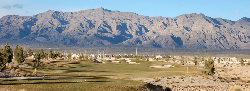
English: The southern section of the Las Vegas Range, and the Aliante Golf Club in the Las Vegas Valley — in Clark County, southern Nevada.
|
| Chanzo | Kazi yangu |
| Mwandishi | Meridethmyers |
Hatimiliki
| I, the copyright holder of this work, release this work into the public domain. This applies worldwide. Katika nchi zingine hii haiwezekani kisheria; kama ni hivyo: I grant anyone the right to use this work for any purpose, without any conditions, unless such conditions are required by law. |
Historia ya faili
Bonyeza tarehe/saa kuona faili kama ilivyoonekana wakati huo.
| Tarehe/Saa | Picha ndogo | Vipimo | Mtumiaji | Maelezo | |
|---|---|---|---|---|---|
| sasa hivi | 22:04, 3 Mei 2008 | 1,011 × 369 (123 KB) | Meridethmyers~commonswiki | {{Information |Description= |Source=self-made |Date= |Author= Meridethmyers |Permission= |other_versions= }} |
Matumizi ya faili
Ukurasa huu umeunganishwa na faili hili:
Matumizi ya faili ulimwenguni
Wiki nyingine hutumia faili hizi:
- Matumizi kwa ar.wikipedia.org
- Matumizi kwa arz.wikipedia.org
- Matumizi kwa azb.wikipedia.org
- Matumizi kwa be-tarask.wikipedia.org
- Matumizi kwa br.wikipedia.org
- Matumizi kwa bs.wikipedia.org
- Matumizi kwa ceb.wikipedia.org
- Matumizi kwa de.wikipedia.org
- Matumizi kwa en.wikipedia.org
- Matumizi kwa en.wikivoyage.org
- Matumizi kwa eo.wikipedia.org
- Matumizi kwa es.wikipedia.org
- Matumizi kwa fa.wikipedia.org
- Matumizi kwa fi.wikipedia.org
- Matumizi kwa fr.wikipedia.org
- Matumizi kwa id.wikipedia.org
- Matumizi kwa ja.wikipedia.org
- Matumizi kwa kw.wikipedia.org
- Matumizi kwa no.wikipedia.org
- Matumizi kwa pms.wikipedia.org
- Matumizi kwa pt.wikipedia.org
- Matumizi kwa ru.wikipedia.org
- Matumizi kwa simple.wikipedia.org
- Matumizi kwa tl.wikipedia.org
- Matumizi kwa tr.wikipedia.org
- Matumizi kwa uk.wikipedia.org
- Matumizi kwa uz.wikipedia.org
- Matumizi kwa war.wikipedia.org
- Matumizi kwa www.wikidata.org
- Matumizi kwa zh.wikipedia.org