Faili:BlankMap-Europe.png

Yaliyomo ya ukurasa hayatumiki katika lugha nyingine.
Kutoka Wikipedia, kamusi elezo huru

BlankMap-Europe.png(piseli 450 × 422, saizi ya faili: 15 KB, aina ya MIME: image/png)

Faili hili linatoka Wikimedia Commons. Maelezo yapo kule kwenye ukurasa wake wa maelezo unaonekana hapo chini.
Commons ni mahali mtandaoni pa kuhifadhia jalada na hati za picha na sauti zenye leseni huria. Unaweza kuisadia.

Muhtasari

Maelezo
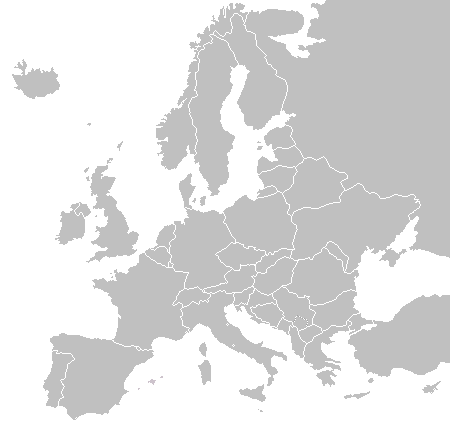
English: A blank political map of Europe as of 2004 (updated 2006 and 2008), made by the uploader for Wikipedia.
The list of independent states pictured on the map (source): Albania, Andorra, Austria, Belarus, Belgium, Bosnia and Herzegovina, Bulgaria, Croatia, Czech Republic, Cyprus, Denmark, Estonia, Finland, France, Germany, Greece, Hungary, Iceland, Ireland, Italy, Latvia, Liechtenstein, Lithuania, Luxembourg, Kosovo (disputed), Macedonia, Moldova, Monaco, Montenegro, Netherlands, Norway, Poland, Portugal, Romania, Russia, San Marino, Serbia, Slovakia, Slovenia, Spain, Sweden, Switzerland, Turkey, Ukraine, United Kingdom, Vatican City
Tarehe 16 Novemba 2003 (original upload date)
Chanzo Kazi yangu
Mwandishi Vardion at Kiingereza Wikipedia

Hatimiliki

Public domain I, the copyright holder of this work, release this work into the public domain. This applies worldwide.
Katika nchi zingine hii haiwezekani kisheria; kama ni hivyo:
I grant anyone the right to use this work for any purpose, without any conditions, unless such conditions are required by law.

Kumbukumbu ya upakizaji wa asili

The original description page was here. All following user names refer to en.wikipedia.
  • 2006-06-10 12:08 Astrokey44 422×422 (10216 bytes) montenegro independent
  • 2006-04-23 18:32 Lgriot 450×422 (7164 bytes) Reverted to earlier revision
  • 2006-04-23 18:32 Lgriot 415×422 (9421 bytes) Reverted to earlier revision
  • 2006-02-22 07:01 BionicWilliam 450×422 (9812 bytes) Reverted to earlier revision
  • 2006-02-22 07:01 BionicWilliam 415×422 (9421 bytes) Reverted to earlier revision
  • 2006-01-04 08:52 E Pluribus Anthony 450×422 (9812 bytes) Blank map of Europe (2005)
  • 2005-09-22 18:14 E Pluribus Anthony 450×422 (9805 bytes) Blank map of Europe (2005)
  • 2005-09-19 09:15 E Pluribus Anthony 450×422 (9804 bytes) Blank map of Europe, 2005
  • 2005-09-19 06:45 E Pluribus Anthony 450×422 (7164 bytes) Blank map of Europe
  • 2005-07-21 05:05 MishaChan 415×422 (5477 bytes) Reverted to earlier revision
  • 2005-07-21 05:04 MishaChan 415×422 (9421 bytes) Reverted to earlier revision
  • 2005-01-22 16:48 Richie 415×422 (5477 bytes) modified Ireland (border), Orkney, Shetlands
  • 2004-09-07 10:53 Gobnuts 415×422 (9421 bytes) Reverted to earlier revision
  • 2004-09-07 10:51 Gobnuts 415×422 (9410 bytes) Reverted to earlier revision
  • 2003-11-16 08:07 Vardion 415×422 (9421 bytes) Blank map of Europe (corrected again)
  • 2003-11-16 08:04 Vardion 415×422 (9410 bytes) Blank map of Europe (corrected)
  • 2003-11-16 07:16 Vardion 415×430 (9113 bytes) Blank map of Europe

Captions

Add a one-line explanation of what this file represents

Items portrayed in this file

depicts Kiingereza

16 Novemba 2003

MIME type Kiingereza

image/png

checksum Kiingereza

fd8d2f1165f0bd5741de4e44d0bdfd3444feb56e

data size Kiingereza

14,906 Baiti

422 pixel

width Kiingereza

450 pixel

Historia ya faili

Bonyeza tarehe/saa kuona faili kama ilivyoonekana wakati huo.

(mpya | zamani) Tazama (10 ya karibu zaidi | ) (10 | 20 | 50 | 100 | 250 | 500)
Tarehe/SaaPicha ndogoVipimoMtumiajiMaelezo
sasa hivi22:02, 23 Septemba 2015Picha ndogo ya toleo la 22:02, 23 Septemba 2015450 × 422 (15 KB)OgreBot(BOT): Reverting to most recent version before archival
22:02, 23 Septemba 2015Picha ndogo ya toleo la 22:02, 23 Septemba 2015450 × 422 (10 KB)OgreBot(BOT): Uploading old version of file from en.wikipedia; originally uploaded on 2006-01-04 08:52:21 by E Pluribus Anthony
22:02, 23 Septemba 2015Picha ndogo ya toleo la 22:02, 23 Septemba 2015450 × 422 (10 KB)OgreBot(BOT): Uploading old version of file from en.wikipedia; originally uploaded on 2005-09-22 18:14:10 by E Pluribus Anthony
22:02, 23 Septemba 2015Picha ndogo ya toleo la 22:02, 23 Septemba 2015450 × 422 (10 KB)OgreBot(BOT): Uploading old version of file from en.wikipedia; originally uploaded on 2005-09-19 09:15:43 by E Pluribus Anthony
22:02, 23 Septemba 2015Picha ndogo ya toleo la 22:02, 23 Septemba 2015450 × 422 (7 KB)OgreBot(BOT): Uploading old version of file from en.wikipedia; originally uploaded on 2005-09-19 06:45:22 by E Pluribus Anthony
22:02, 23 Septemba 2015Picha ndogo ya toleo la 22:02, 23 Septemba 2015415 × 422 (5 KB)OgreBot(BOT): Uploading old version of file from en.wikipedia; originally uploaded on 2005-01-22 16:48:46 by Richie
22:01, 23 Septemba 2015Picha ndogo ya toleo la 22:01, 23 Septemba 2015415 × 422 (9 KB)OgreBot(BOT): Uploading old version of file from en.wikipedia; originally uploaded on 2003-11-16 08:04:27 by Vardion
22:01, 23 Septemba 2015Picha ndogo ya toleo la 22:01, 23 Septemba 2015415 × 430 (9 KB)OgreBot(BOT): Uploading old version of file from en.wikipedia; originally uploaded on 2003-11-16 07:16:14 by Vardion
19:27, 21 Julai 2009Picha ndogo ya toleo la 19:27, 21 Julai 2009450 × 422 (15 KB)Hoshiefixed Montenegro
08:20, 18 Julai 2009Picha ndogo ya toleo la 08:20, 18 Julai 2009450 × 422 (15 KB)Hoshieredid Kosovo/Montenegro borders based on an older version of File:Continental-Europe-map.png; anti-aliasing has been removed.
(mpya | zamani) Tazama (10 ya karibu zaidi | ) (10 | 20 | 50 | 100 | 250 | 500)

Kurasa hizi 2 zimeunganishwa na faili hili:

Matumizi ya faili ulimwenguni

Wiki nyingine hutumia faili hizi:

Data juu