
Faili:Aerial-GoletaArea.jpg
Ukubwa wa hakikisho: piseli 800 × 323. Ukubwa zingine: piseli 320 × 129 | piseli 1,024 × 413.
Faili halisi (piseli 1,024 × 413, saizi ya faili: 109 KB, aina ya MIME: image/jpeg)
| Faili hili linatoka Wikimedia Commons. Maelezo yapo kule kwenye ukurasa wake wa maelezo unaonekana hapo chini.
|
Muhtasari
| Maelezo |
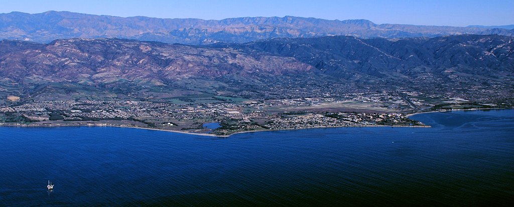
Aerial photo of the Goleta area, Santa Barbara County, California — from offshore.
|
| Tarehe | 11am |
| Chanzo | Kazi yangu |
| Mwandishi | John Wiley User:Jw4nvc - Santa Barbara, California |
| Ruhusa (Kutumia faili tena) |
*For full details on Permissions for this user's work, see: User:Jw4nvc/permission/details |
Hatimiliki
I, the copyright holder of this work, hereby publish it under the following license:
This file is licensed under the Creative Commons Attribution 3.0 Unported license.
- Uko huru:
- kushiriki – kunakili na kusambaza kazi hiyo
- kwa remix – kurekebisha kazi
- Chini ya masharti yafuatayo:
- sifa – Ni lazima utoe mkopo unaofaa, utoe kiungo cha leseni, na uonyeshe ikiwa mabadiliko yalifanywa. Unaweza kufanya hivyo kwa njia yoyote inayofaa, lakini si kwa njia yoyote inayopendekeza mtoa leseni akuidhinishe wewe au matumizi yako.
Historia ya faili
Bonyeza tarehe/saa kuona faili kama ilivyoonekana wakati huo.
| Tarehe/Saa | Picha ndogo | Vipimo | Mtumiaji | Maelezo | |
|---|---|---|---|---|---|
| sasa hivi | 22:19, 28 Januari 2009 | 1,024 × 413 (109 KB) | Jw4nvc | == Summary == {{Information |Description=Aerial photo of Goleta, California area from offshore |Source=self-made |Date=January 12, 2009 11am |Author= MyName (Jw4nvc (<span class="signature-talk">talk</span>)) |other_v |
Matumizi ya faili
Ukurasa huu umeunganishwa na faili hili:
Matumizi ya faili ulimwenguni
Wiki nyingine hutumia faili hizi:
- Matumizi kwa ar.wikipedia.org
- Matumizi kwa arz.wikipedia.org
- Matumizi kwa azb.wikipedia.org
- Matumizi kwa bg.wikipedia.org
- Matumizi kwa ceb.wikipedia.org
- Matumizi kwa ce.wikipedia.org
- Matumizi kwa de.wikivoyage.org
- Matumizi kwa en.wikipedia.org
- Matumizi kwa es.wikipedia.org
- Matumizi kwa eu.wikipedia.org
- Matumizi kwa fa.wikipedia.org
- Matumizi kwa fr.wikipedia.org
- Matumizi kwa ht.wikipedia.org
- Matumizi kwa hu.wikipedia.org
- Matumizi kwa it.wikipedia.org
- Matumizi kwa it.wikivoyage.org
- Matumizi kwa ja.wikipedia.org
- Matumizi kwa lld.wikipedia.org
- Matumizi kwa ml.wikipedia.org
- Matumizi kwa mt.wikipedia.org
- Matumizi kwa no.wikipedia.org
- Matumizi kwa pl.wikipedia.org
- Matumizi kwa pt.wikipedia.org
- Matumizi kwa sr.wikipedia.org
- Matumizi kwa tr.wikipedia.org
- Matumizi kwa tt.wikipedia.org
- Matumizi kwa uk.wikipedia.org
- Matumizi kwa ur.wikipedia.org
- Matumizi kwa vo.wikipedia.org
- Matumizi kwa www.wikidata.org
- Matumizi kwa zh-min-nan.wikipedia.org