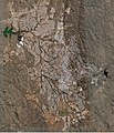
Faili:Satellitenbild Windhoek.jpg

Ukubwa wa hakikisho: piseli 516 × 599. Ukubwa zingine: piseli 207 × 240 | piseli 413 × 480 | piseli 784 × 910.
Faili halisi (piseli 784 × 910, saizi ya faili: 192 KB, aina ya MIME: image/jpeg)
Historia ya faili
Bonyeza tarehe/saa kuona faili kama ilivyoonekana wakati huo.
| Tarehe/Saa | Picha ndogo | Vipimo | Mtumiaji | Maelezo | |
|---|---|---|---|---|---|
| sasa hivi | 18:44, 28 Mei 2007 |  | 784 × 910 (192 KB) | Foundert~commonswiki | * Satellitenaufnahme {{Information |Description=de: Satellitenbild der Stadt Windhoek, Namibia; das Stadtzentrum ist in der rechten Bildmitte zu sehen; en: satellite picture of the city of Windhoek Namibia. the city center is visible in the righ |
Matumizi ya faili
Hakuna kurasa zozote zinazotumia faili hii.
Matumizi ya faili ulimwenguni
Wiki nyingine hutumia faili hizi:
- Matumizi kwa af.wikipedia.org
- Matumizi kwa de.wikipedia.org
- Matumizi kwa nds.wikipedia.org

