
Faili:Connecticut River Map.png
Ukubwa wa hakikisho: piseli 448 × 600. Ukubwa zingine: piseli 179 × 240 | piseli 578 × 774.
Faili halisi (piseli 578 × 774, saizi ya faili: 58 KB, aina ya MIME: image/png)
| Faili hili linatoka Wikimedia Commons. Maelezo yapo kule kwenye ukurasa wake wa maelezo unaonekana hapo chini.
|
Muhtasari
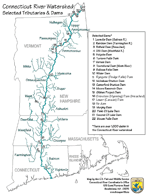
| Maelezo | Map of the Connecticut River, New England, USA. This map was prepared by the United States Fish and Wildlife Service, and as a product of the United States Government is in the public domain and not subject to copyright restrictions. | |||
| Chanzo | Originally from en.wikipedia; description page is/was here. Original uploader was Daderot at Kiingereza Wikipedia | |||
| Mwandishi | USGov | |||
| Ruhusa (Kutumia faili tena) |
|


|
This transport map image could be re-created using vector graphics as an SVG file. This has several advantages; see Commons:Media for cleanup for more information. If an SVG form of this image is available, please upload it and afterwards replace this template with
{{vector version available|new image name}}.
It is recommended to name the SVG file “Connecticut River Map.svg”—then the template Vector version available (or Vva) does not need the new image name parameter. |
Kumbukumbu ya upakizaji wa asili
| Tarehe/Saa | Vipimo | Mtumiaji | Maelezo |
|---|---|---|---|
| 6 Januari 2008, 16:02:00 | 580 × 778 (61343 bytes) | Gridge (majadiliano · michango) | {{Information |Description=Map of the Connecticut River, New England, USA. This map was prepared by the United States Fish and Wildlife Service, and as a product of the United States Government is in the public domain and not subject to copyright restrict |
Historia ya faili
Bonyeza tarehe/saa kuona faili kama ilivyoonekana wakati huo.
| Tarehe/Saa | Picha ndogo | Vipimo | Mtumiaji | Maelezo | |
|---|---|---|---|---|---|
| sasa hivi | 08:26, 10 Machi 2024 | | 578 × 774 (58 KB) | Lojwe | Cropped < 1 % horizontally, 1 % vertically using CropTool with precise mode. |
| 04:45, 25 Novemba 2014 |  | 580 × 778 (74 KB) | GifTagger | Bot: Converting file to superior PNG file. (Source: Connecticut_River_Map.gif). This GIF was problematic due to non-greyscale color table. |
Matumizi ya faili
Ukurasa huu umeunganishwa na faili hili:
Matumizi ya faili ulimwenguni
Wiki nyingine hutumia faili hizi:
- Matumizi kwa bg.wikipedia.org
- Matumizi kwa cs.wikipedia.org
- Matumizi kwa da.wikipedia.org
- Matumizi kwa de.wikipedia.org
- Matumizi kwa en.wikipedia.org
- Matumizi kwa es.wikipedia.org
- Matumizi kwa fi.wikipedia.org
- Matumizi kwa fr.wikipedia.org
- Matumizi kwa fy.wikipedia.org
- Matumizi kwa he.wikipedia.org
- Matumizi kwa incubator.wikimedia.org
- Matumizi kwa it.wikipedia.org
- Matumizi kwa ja.wikipedia.org
- Matumizi kwa nl.wikipedia.org
- Matumizi kwa pt.wikipedia.org
- Matumizi kwa ru.wikipedia.org
- Matumizi kwa simple.wikipedia.org
- Matumizi kwa sv.wikipedia.org
- Matumizi kwa ta.wikipedia.org
- Matumizi kwa th.wikipedia.org
- Matumizi kwa www.wikidata.org
- Matumizi kwa zh.wikipedia.org